Citrus Heights, CA sits about 15 miles northeast of downtown Sacramento along the busy Interstate 80 corridor. Incorporated in 1997, this Sacramento County municipality operates its own local government and police force separate from the surrounding unincorporated areas. Before incorporation, the area relied on county sheriffs for law enforcement, a detail that shaped the city's modern approach to public safety.
Buyers researching the Sacramento metropolitan area often look at this city for its mid-range housing prices and proximity to major employment centers. The local housing market features mostly mid-century construction, offering an alternative to the newer, more expensive subdivisions in neighboring Placer County. Evaluating the area requires looking at recent property crime reports, local policing initiatives, and commuting patterns.
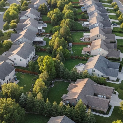
The city covers roughly 14 square miles and houses over 85,000 residents as of 2026. This density means residential neighborhoods frequently intersect with commercial strips and retail centers. Understanding how these zones overlap helps buyers identify which specific blocks meet their daily needs.
Crime Statistics and Local Trends
The Citrus Heights Police Department reported a 54.5 percent decrease in overall crime between 2007 and early 2026. The city's violent crime rate currently hovers around 5 to 5.3 incidents per 1,000 residents. This figure includes reports of assaults and robberies across the city, with incidents often concentrated near late-night commercial establishments.
Property crime occurs more frequently, with local data showing about 29.6 incidents per 1,000 residents. The majority of these reports involve vehicle theft, residential burglary, and retail theft near busy commercial corridors like Sunrise Boulevard. When compared to the broader California state data, the overall crime rate in Citrus Heights aligns closely with the national average for suburban municipalities of similar size and density.
Buyers should review neighborhood-specific crime maps rather than relying solely on citywide averages. Incident reports tend to cluster near high-traffic retail centers, transit stops, and major arterial roads. Interior residential streets, particularly those featuring cul-de-sacs, generally record fewer property crime calls.
The local police department publishes weekly crime logs and maintains an online mapping tool for the public. Residents can use this database to search specific street addresses and view a 90-day history of police responses. This transparency allows incoming buyers to verify the exact call volume on their prospective street before submitting an offer.
Community Programs from the Local Police Department
The local police department funds several public initiatives aimed at community support and youth engagement. The Police Activities League organizes sports leagues, after-school events, and mentorship programs for local students throughout the year. These programs aim to build early, positive relationships between young residents and local officers.
For young adults ages 14 to 20 interested in law enforcement careers, the department runs a dedicated Police Explorer Program. Participants receive classroom instruction and hands-on training regarding police protocols, traffic control, and community service. This initiative frequently serves as a recruitment pipeline for the department's future dispatchers and patrol officers.
Adult and senior residents have access to specialized services directly through the municipal government. Project Lifesaver provides tracking bracelets to eligible residents diagnosed with Alzheimer's, dementia, or autism. If a registered resident wanders away from home, first responders can use specialized radio frequency equipment to locate them quickly.
The city also employs a Homeless Navigator program to address issues related to the unhoused population. This initiative connects individuals sleeping in public spaces with specific Sacramento County resources, temporary shelter options, and medical care. The program aims to reduce trespassing calls and ease the burden on emergency response teams.
Commuting Times and Local Amenities
Commuters driving from Citrus Heights, CA to downtown Sacramento usually spend 20 to 30 minutes on Interstate 80 during off-peak hours. That drive time can extend to a full 60 minutes during morning and evening rush hour traffic. The Auburn Boulevard corridor provides a secondary surface-street route into the city, though frequent traffic lights make it a slower alternative.
Residents looking for alternatives to driving can use the SacRT bus system, which operates multiple routes through the city. These buses connect directly to light rail stations in nearby communities like North Highlands, CA and Sacramento. The light rail provides a direct commute into the downtown state government buildings without the hassle of paid parking.
Retail and recreation options are distributed throughout the city limits and just beyond the borders. Local shopping centers include the long-standing Sunrise Mall, which serves as a central retail hub for the immediate area. For higher-end retail and dining, the larger Westfield Galleria at Roseville sits just a short drive north across the county line.
Buyers prioritizing outdoor space will find public facilities like Arcade Creek Park Preserve and Rusch Community Park. Rusch Park features public swimming pools, basketball courts, and extensive paved trails. The Arcade Creek area offers natural walking paths that provide a break from the surrounding suburban traffic.
Real Estate Market Data and Public Schools
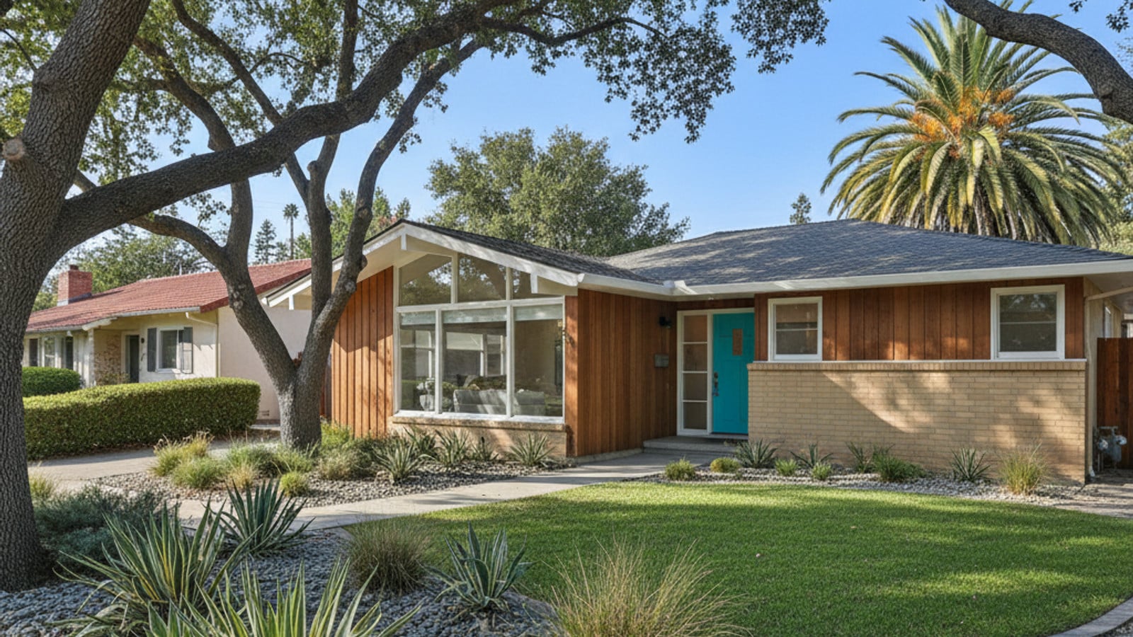
The median home value in Citrus Heights, CA sits between $440,000 and $475,000 as of mid-2026. This pricing makes the city a frequent target for buyers priced out of neighboring Roseville, CA or the newer developments in Folsom. A buyer with a budget under $500,000 can still find detached properties here, which is increasingly rare in the broader Sacramento metropolitan area.
The local housing inventory primarily consists of mid-century single-family homes built between the 1960s and 1980s. These older subdivisions often feature mature trees, larger lot sizes, and established neighborhood associations without mandatory HOA fees. Buyers will also find scattered townhouses and apartment complexes near the major retail corridors.
Students living in the city attend schools within the San Juan Unified School District. This district covers a large portion of eastern Sacramento County and operates multiple elementary, middle, and high schools within the Citrus Heights city limits. Buyers should look up specific school boundary maps, as attendance zones can split along major roads like Greenback Lane.
Property taxes and insurance rates generally mirror the rest of the Sacramento region, though older homes may require updated electrical or plumbing systems to secure favorable insurance premiums. Buyers should calculate their monthly payments using the current local rates rather than state averages to get an accurate picture of ownership costs.
Frequently Asked Questions
What is the crime rate in Citrus Heights, CA?
The city records approximately 5.3 violent crimes and 29.6 property crimes per 1,000 residents in 2026. These numbers represent a long-term downward trend since the local police department formed over two decades ago. The majority of reported incidents involve property-related offenses like car break-ins rather than violent encounters.
Is Citrus Heights a nice place to live?
The city offers lower median home prices than many surrounding suburbs while maintaining quick access to Interstate 80. Residents benefit from numerous public parks, local retail centers, and established public schools. The commute to downtown Sacramento remains manageable for daily workers, typically taking under 30 minutes outside of rush hour.
What are the safest neighborhoods in Citrus Heights?
Crime patterns vary block by block, with interior residential streets generally seeing fewer incidents than commercial corridors. Buyers should consult the local police department's online crime mapping tool to review recent calls for service around specific addresses. Areas bordering Arcade Creek or the northern edge near Roseville, CA often feature different property types and traffic patterns that influence local data.
Check out this article next