The citywide average commute time for a resident living in Citrus Heights, CA is approximately 27 minutes. Located between several major employment centers, the city offers straightforward access to downtown Sacramento, Roseville, and Folsom. Many buyers evaluate this location specifically for its central position within the broader regional transportation network.
Residents primarily rely on a mix of personal vehicles and public transportation to reach their jobs. The local infrastructure includes major arterial roads that feed directly into the interstate system. Understanding these daily travel patterns helps buyers choose the right neighborhood for their specific work destination.
The 2026 local economy sees workers commuting in multiple directions rather than a single downtown rush. Commuters head toward healthcare hubs in Placer County just as often as government offices in the state capitol. This multi-directional traffic flow makes estimating travel times dependent on the specific route and time of day.
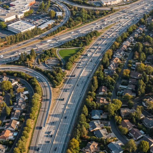
Highway Access and Local Road Networks
Interstate 80 and US Highway 50 serve as the primary freeway options for regional travel out of the city. Drivers access these major corridors through a grid of wide, multi-lane local surface streets. Sunrise Boulevard and Greenback Lane handle the bulk of this local traffic, acting as the main arteries connecting residential areas to the highways.
Interstate 80 carries northbound traffic toward Roseville, CA and southbound traffic toward the state capitol. US Highway 50 sits further south and provides a direct path toward Folsom, CA and Rancho Cordova. Which freeway a driver uses depends entirely on where their house sits within the city limits.
Driving through the local street grid during peak hours requires an understanding of school zones and commercial centers. Traffic lights along Antelope Road and Madison Avenue dictate the pace of morning travel before drivers ever reach a freeway on-ramp. Buyers should map the distance from their driveway to the nearest major intersection when estimating their daily schedule.
Driving Into Downtown Sacramento
The distance from the center of town to downtown Sacramento, CA is about 16 miles. During morning rush hour, dense traffic on Interstate 80 stretches this drive to roughly 25 to 35 minutes. Commuters traveling off-peak can usually cover the same distance in 20 to 25 minutes.
Drivers should factor in potential delays around the Interstate 80 interchange near Watt Avenue. Accidents or construction in this specific zone routinely add 10 to 15 minutes to the morning schedule. Alternate routes using surface streets rarely save time during these freeway backups.
Parking availability in downtown Sacramento also impacts the total morning travel time. Workers heading to state agency buildings often spend an additional five to ten minutes locating a garage space and walking to their office. Factoring this final leg of the trip provides a more accurate picture of the morning routine.
Getting to Roseville and Folsom
The drive to commercial centers in Roseville takes about 15 to 20 minutes using either local roads or Interstate 80. Traffic heading north into Placer County generally moves faster than the southbound flow toward Sacramento. Many workers find this shorter trip makes the northern edge of the city a practical home base.
Traveling southeast to Folsom requires 25 to 30 minutes of driving. Commuters usually take Hazel Avenue or Sunrise Boulevard south to connect with US Highway 50. The evening return trip from Folsom often sees increased congestion near the freeway exits.
Commuters heading to the Folsom tech corridor should anticipate stop-and-go conditions along the American River crossing. The limited number of bridges connecting the two areas creates natural traffic funnels during the afternoon rush. Alternate paths through Orangevale offer a more consistent, albeit slightly slower, driving pace.
Public Transportation and Bus Services
The Sacramento Regional Transit District operates the local public transport network. This system includes both fixed bus routes and light rail stations located just outside the city borders. Commuters without a personal vehicle use the bus service to connect directly to the broader regional train network.
A standard single ride fare costs $2.50, and riders can pay using a mobile app or a reloadable transit card. Monthly passes offer a cost-effective alternative for daily riders. The total transit time from the center of town to downtown Sacramento averages 45 to 50 minutes.
Two primary bus routes serve the local population and link to the light rail system. Route 21 runs down Sunrise Boulevard and drops passengers at the Mather Field/Mills Station to catch the Gold Line. Route 1 travels along Greenback Lane, delivering riders to the Watt/I-80 Station to board the Blue Line.
The transit district frequently updates schedules to match shifting commuter habits. Buses on the main arterial roads typically arrive every 15 to 30 minutes during peak morning hours. Riders should check the most recent timetables on the transit app before planning their morning departure.
Evaluating Alternative Routes and Carpooling
Carpool lanes on Interstate 80 offer a measurable time advantage for commuters traveling with passengers. Vehicles with two or more occupants can bypass the most dense congestion during the morning and evening rush hours. This dedicated lane often reduces the drive to downtown Sacramento by up to ten minutes.
Many local employers coordinate rideshare programs to help workers manage their daily travel. Connecting with neighbors who work in the same commercial hubs cuts down on individual fuel consumption and vehicle wear. These organized carpools utilize designated park-and-ride lots located near the major freeway entrances.
Bicycling to work serves as a practical option for residents employed within the city limits or in neighboring Roseville. The city maintains a growing network of marked bike lanes along secondary roads like Fair Oaks Boulevard. Cyclists should map their routes carefully to avoid the high-speed traffic on primary commercial corridors.
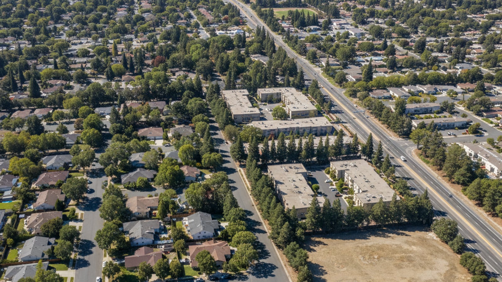
How Housing Location Affects the Daily Drive
The local real estate market consists of a mix of single-family homes and apartment complexes spread across the city grid. Properties located near the Sunrise MarketPlace commercial center offer immediate access to major bus lines. Buyers focused on public transit often target these established neighborhoods along the Greenback Lane corridor.
Homes situated on the northern edge of the city provide a shorter, more direct drive to Roseville employment hubs. Residents in these northern subdivisions can often bypass the freeways entirely by using local surface streets. This cuts down on daily fuel costs and avoids unexpected interstate delays.
Checking Commute Times From Citrus Heights, CA requires testing the specific route during peak traffic hours before making an offer on a property. A house located just two miles further from a freeway on-ramp can add ten minutes to a morning commute. Mapping the exact travel time from a specific address provides the most accurate estimate for getting to work.
Proximity to local schools also dictates morning traffic flow within residential subdivisions. Neighborhoods bordering San Juan Unified School District campuses see a surge in vehicle volume between 7:30 AM and 8:15 AM. Buyers should drive through their prospective neighborhood during these times to gauge the true street-level congestion.
Frequently Asked Questions
What is the average commute time from Citrus Heights, CA to Sacramento?
A typical morning drive into downtown Sacramento takes 25 to 35 minutes via Interstate 80. Public transit riders using the bus and light rail system should expect the trip to take about 45 to 50 minutes. Leaving before 7:00 AM generally shaves five to ten minutes off the highway drive.
Is public transit available in Citrus Heights, CA?
Yes, the Sacramento Regional Transit District provides regular bus service throughout the city limits. These buses run along major corridors like Sunrise Boulevard and connect directly to nearby light rail stations. The light rail trains then carry passengers into the surrounding urban centers.
How far is the drive from Citrus Heights, CA to Roseville?
The drive to Roseville covers roughly five to eight miles depending on the exact starting point. Most drivers complete this trip in 15 to 20 minutes using local roads like Auburn Boulevard. It is one of the shortest regional commutes available to local residents.
Check out this article next