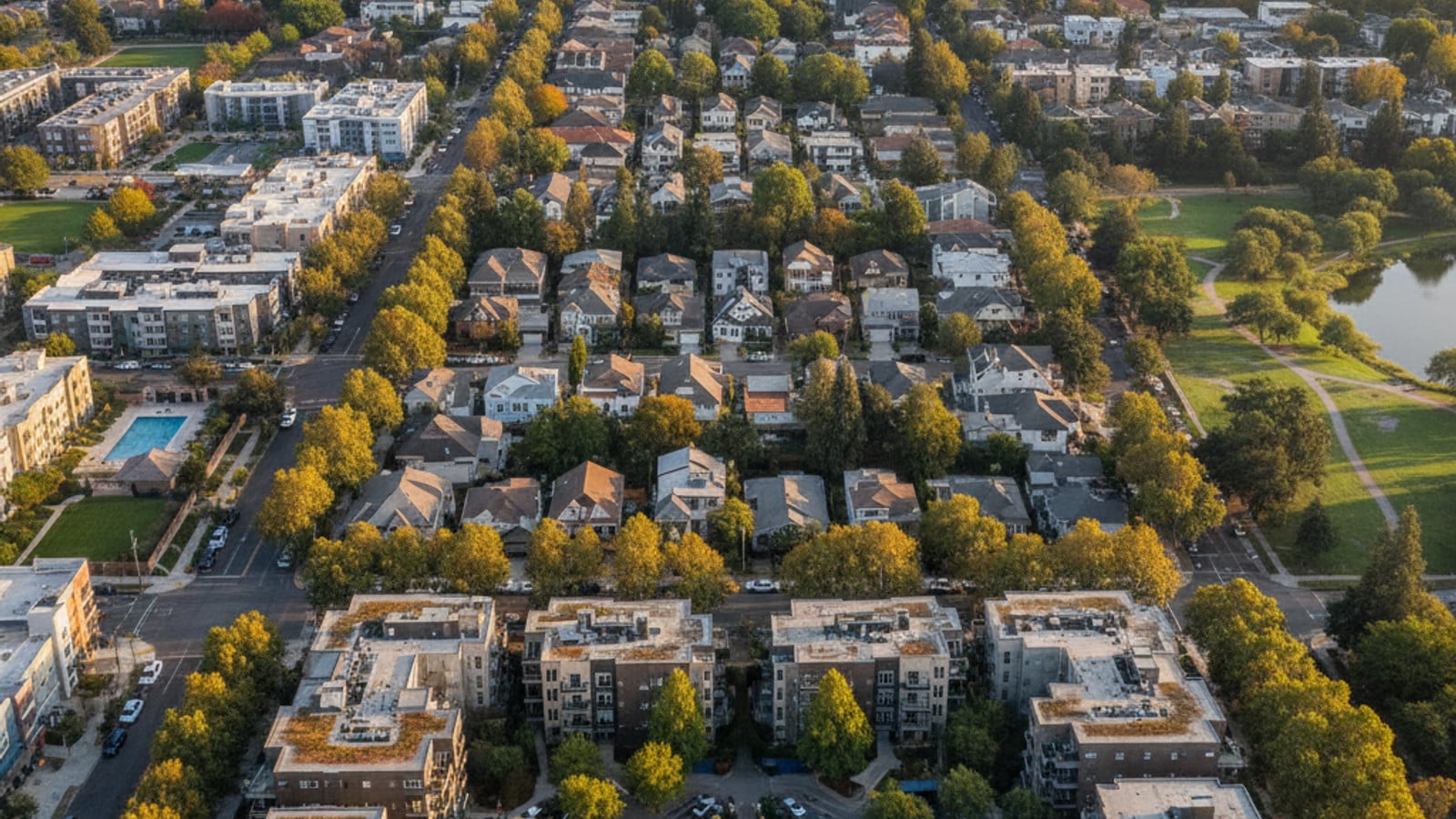
Sacramento sits at the intersection of major interstates and an expanding regional transit network. The city covers nearly 100 square miles, meaning your daily travel experience depends entirely on where you buy or rent. Two major rivers also divide the geography, creating natural bottlenecks that influence daily traffic patterns.
Many recent buyers prioritize proximity to the light rail or specific highway corridors to trim their commute times. Understanding the local infrastructure helps you match a neighborhood to your daily routine. Exploring these transit networks early in your housing search prevents unexpected commute frustrations later.
The local housing market offers everything from dense urban condominiums to larger suburban single-family homes. Each property type comes with a different set of commute expectations and transportation costs. Figuring out how you prefer to travel will quickly narrow down your list of target neighborhoods.
Options for Leaving the Car at Home
The Sacramento Regional Transit District operates across 432 square miles of the metropolitan area. Residents have access to a mix of traditional bus routes, light rail lines, and on-demand micro-transit. This coverage allows people in the central neighborhoods to completely bypass daily driving.
Uber and other major rideshare platforms maintain a strong presence throughout the city core and surrounding suburbs. For localized trips, the SmaRT Ride shuttle service functions as an on-demand micro-transit option. This service operates in designated zones, picking up riders and dropping them off anywhere within that specific boundary.
Passengers can request a SmaRT Ride pickup through a smartphone app, similar to a private rideshare. The shuttle groups passengers heading in the same direction, reducing local traffic and providing a cost-effective alternative to private cars. The service links traditional bus stops directly to final destinations.
Many local employers also offer commuter benefit programs that subsidize transit costs. These corporate incentives encourage residents to leave their private vehicles at home during the workweek. Combining employer benefits with the local transit infrastructure can noticeably reduce your monthly transportation budget.
Riding the Regional Transit System
The SacRT system forms the backbone of public transportation in the capital region. The network connects residential corridors directly to major employment centers in downtown Sacramento. Many suburban stations feature free park-and-ride lots, allowing commuters to drive partway before boarding a train.
During peak morning and afternoon hours, light rail trains typically run at 15-minute intervals. This frequency makes it easy to commute without rigidly planning your departure around a sparse schedule. Midday and weekend services run slightly less frequently, usually operating on 30-minute intervals.
You can pay the $2.50 basic single fare using cash, a daily pass, or digital payment methods. The system completed its transition to the Transit Connect app in April 2026, streamlining mobile ticketing for regular commuters. Riders can scan their phones at farebox readers upon boarding.
The light rail and bus networks break down into several primary routes:
Blue Line: Connects the northern suburbs near Interstate 80 down through the city center to south Sacramento.
Gold Line: Runs east from downtown through Rancho Cordova and out to Folsom.
Green Line: Provides targeted service north of downtown to the River District.
Bus Routes: Dozens of fixed routes supplement the rail network to cover areas without train stations.
Local Walking and Biking Trails
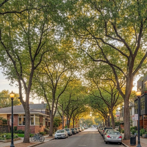
Sacramento holds an overall Walk Score of 49 and a Bike Score of 68, but those citywide averages obscure major neighborhood differences. The Midtown area routinely posts Walk Scores in the 90s due to its dense grid of restaurants, shops, and grocery stores. Residents in these central zip codes often walk for all their daily errands.
Sacramento is known for its extensive urban tree canopy, which provides valuable shade for pedestrians during the hot summer months. This natural cover makes walking and biking more comfortable even when temperatures rise. The flat terrain also removes the physical strain associated with commuting in hillier cities.
Bicyclists benefit from dedicated lanes, protected intersections, and extensive off-street paths. The American River Bike Trail offers 32 miles of paved, car-free riding from Discovery Park all the way to Folsom Lake. Commuters frequently use this trail to bypass highway traffic entirely during the morning rush.
Buyers prioritizing a car-free lifestyle should focus their property search on the central grid. Suburban developments outside the core generally require a vehicle for daily errands. Electric scooters and bike-share programs also operate throughout the downtown area for short, last-mile trips.
Driving the Major Highway Corridors
The average commute time for drivers in the Sacramento region hovers between 23 and 26 minutes. Four major highway corridors dictate the flow of traffic across the metropolitan area. The specific suburb you choose will determine which of these arteries you rely on daily.
Interstate 5 runs north to south, while Interstate 80 handles east-west travel across the northern edge of the city. US Highway 50 carries traffic east toward the foothills, and State Route 99 heads south through Elk Grove. The interchanges where these highways meet often see the heaviest volume during commute hours.
To help manage congestion, several of these highways feature High Occupancy Vehicle (HOV) lanes. Carpoolers, buses, and drivers with qualifying clean-air vehicles can use these lanes to bypass standard traffic. Accessing the HOV lanes can shave minutes off a daily commute from the outer suburbs.
Peak afternoon traffic typically builds between 3:00 PM and 5:00 PM, especially on eastbound US-50 and northbound I-5. The widespread adoption of hybrid work schedules has slightly flattened these peak periods, spreading congestion more evenly throughout the afternoon. Fridays tend to see earlier traffic buildups as residents head toward Lake Tahoe or the Bay Area for the weekend.
Buyers should test drive their anticipated commute during typical rush hours before submitting an offer. A house that feels close on a map can take twice as long to reach during the afternoon peak. Factoring in bridge crossings over the Sacramento or American rivers is also a smart step, as these routes offer limited detours.
Connecting to the Airport and Regional Trains
Sacramento International Airport sits roughly 10 miles northwest of the downtown core. The drive typically takes 15 to 20 minutes via Interstate 5 under normal traffic conditions. The facility serves as the primary aviation hub for the region, offering direct flights across the country.
Unlike the massive aviation centers in the Bay Area, this local airport features a smaller footprint that makes parking and security lines much more manageable. Travelers rarely need to budget hours of buffer time just to reach their gate. This convenience is a major selling point for buyers who travel frequently for business.
SacRT operates an express bus route connecting the city center directly to the airport terminals. Ride-hailing services and traditional taxis also maintain dedicated pickup zones at both Terminal A and Terminal B. Off-site parking facilities provide continuous shuttle service for travelers leaving their cars for extended trips.
For regional rail travel, the Sacramento Valley Station serves as the primary Amtrak hub. The station provides direct connections to the San Francisco Bay Area via the Capitol Corridor line. Many residents use this train service to commute to jobs in the Bay Area without driving on Interstate 80.
Housing location dictates your access to these travel centers. Downtown condominiums offer immediate proximity to the Amtrak station, while suburban single-family homes often require a longer drive or a connecting light rail trip to reach regional transit hubs. Buyers who travel frequently should weigh the distance to these facilities when comparing neighborhoods.
Frequently Asked Questions
Is public transportation free in Sacramento?
Standard fares apply for most adult riders on the SacRT system. A basic single ride costs $2.50, though frequent riders can purchase monthly passes for better value. The RydeFreeRT program does allow students in grades TK through 12 to ride the entire network at no cost.
Is Sacramento a walkable city?
Walkability depends entirely on your specific zip code. Neighborhoods like Midtown and Downtown feature dense, grid-like streets where you can easily reach grocery stores and cafes on foot. Suburban areas further from the city center rely on cars for almost all daily errands.
How do I get from Sacramento Airport (SMF) to downtown?
Driving or taking a rideshare down Interstate 5 is the fastest method, usually taking about 15 minutes. SacRT also runs the Route 142 express bus, which provides a direct link between the airport terminals and the downtown grid. Rental car facilities are located on the airport property and accessible via a continuous shuttle service.
Check out this article next