Placer County's largest city sits at a major regional crossroads, making transportation a primary factor for anyone moving here. Getting around Roseville, CA involves a mix of highway driving, local bus networks, and regional rail connections. Most residents rely on personal vehicles, but alternative transit options have expanded to meet the needs of a growing population.
The city's layout spreads across 44 square miles, with commercial hubs concentrated near major interchanges. Commuters traveling to downtown Sacramento or the Bay Area have multiple routes to choose from, depending on their schedule and preferred mode of travel. Understanding this network helps buyers choose a location that aligns with their daily routine.
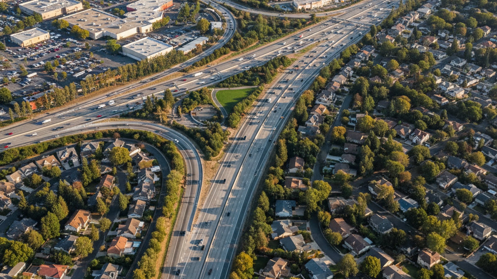
Highway Access and Daily Drive Times
Interstate 80 and State Route 65 form the primary transportation spine through Roseville. I-80 runs southwest toward Sacramento and northeast toward the Sierra Nevada Mountains. State Route 65 cuts north through the city, connecting residents to Lincoln and nearby commercial centers.
A standard drive from Roseville to downtown Sacramento takes about 30 to 45 minutes under normal conditions. Morning and afternoon peak hours change this timeline considerably. Commuters traveling between 7:00 AM and 9:00 AM should expect the trip to exceed 60 minutes.
The interchange where I-80 meets SR-65 is a known choke point during the afternoon rush hour. Drivers returning from Sacramento often encounter slow-moving traffic as vehicles merge onto the northbound route. Buyers should test this drive during peak hours to gauge the commute from specific neighborhoods.
When highways back up, locals often use major surface streets like Douglas Boulevard and Sunrise Avenue to move across town. These multi-lane roads handle high traffic volumes but feature synchronized stoplights to keep vehicles moving. Learning these alternate routes saves time during major highway delays.
The city has invested in widening projects along the SR-65 corridor to alleviate bottlenecks. The Galleria Boulevard and Stanford Ranch Road interchanges see heavy use during the holiday shopping season. Buyers looking at homes in these central zones should factor seasonal traffic into their travel plans.
Local Bus Routes and On-Demand Transit
Roseville Transit operates several fixed-route buses that connect residential neighborhoods to major retail and employment centers. These routes run Monday through Saturday, providing an alternative to driving for daily errands. The system coordinates with Placer County Transit, allowing riders to transfer for trips into neighboring towns like Rocklin and Auburn.
For professionals working in the state capital, the Commuter bus service provides a direct option. These buses depart from Roseville park-and-ride lots in the morning and return from downtown Sacramento in the afternoon. Many state workers use this service to avoid highway congestion and downtown parking fees.
The city also offers Arrow, an on-demand ride service that functions similarly to rideshare apps but operates within the municipal transit system. Residents can book a ride through a smartphone app or over the phone. The vehicles provide curb-to-curb service within the city limits.
Fares for these services are standardized across the city to keep public transportation accessible. Riders pay upon boarding using cash, a transit card, or a mobile app. Current single-trip costs include:
- Local fixed-route single fare: $1.50
- Arrow on-demand service: $2.50 per ride
- Commuter bus fare for residents: $3.25 per trip
Train Travel and Airport Connections
The Capitol Corridor train station sits in Old Town Roseville, providing a direct rail link to Sacramento and the San Francisco Bay Area. Amtrak operates this route, with multiple daily departures heading west. The train trip to the Sacramento station takes about 25 to 30 minutes.
Riding the train offers a predictable schedule that avoids highway delays entirely. Many regional commuters prefer this option because it allows them to work or read during the trip. The station includes a park-and-ride lot, making it accessible for residents living in the outer subdivisions.
Beyond the Capitol Corridor, the station connects to Amtrak Thruway buses that travel to destinations not served by rail. This expands the reach of the local transit hub for weekend trips or longer journeys. The ticketing office and waiting area offer basic amenities for travelers.
For air travel, residents use Sacramento International Airport, located about 30 miles west of the city. The most direct route involves taking I-80 west to I-5 north. Without traffic, the drive to the airport terminals takes roughly 35 minutes.
Biking Infrastructure and Pedestrian Paths
The Miner's Ravine Trail provides a paved, 6.37-mile multi-use path that runs through the center of the city. Cyclists and pedestrians use this trail for both recreation and commuting. It connects several parks and residential areas directly to the downtown district, bypassing vehicle traffic.
Beyond the trail system, the city maintains designated bike lanes along most major thoroughfares. New residential developments typically include wide sidewalks and dedicated bike racks near commercial plazas. The terrain is largely flat, which makes cycling a practical option for short trips.
Pedestrian access varies greatly depending on the neighborhood. Areas around the Fountains and the Westfield Galleria feature extensive crosswalks and paved walkways designed for foot traffic. In contrast, the newer subdivisions on the western edge of the city require a car to reach grocery stores and retail centers.
The city continues to expand its active transportation network, including connections to the Dry Creek Greenway. These ongoing projects aim to link more neighborhoods to schools and shopping districts without requiring a car. Buyers who prioritize cycling should look for homes near these established trailheads.
Frequently Asked Questions
Is Roseville a walkable city?
Walkability depends on the specific neighborhood. Old Town and the retail corridors near the Galleria offer excellent pedestrian access to shops and restaurants. The broader city, however, features a suburban layout where most residents need a car for daily errands.
Does BART go to Roseville?
The Bay Area Rapid Transit (BART) system does not extend into Placer County. Residents traveling to the Bay Area can take the Capitol Corridor train from the local Amtrak station instead. That train connects directly to the BART system at the Richmond and Oakland Coliseum stations.
How much does it cost to ride Roseville Transit?
A standard single ride on the local fixed-route bus costs $1.50. The Arrow on-demand service charges $2.50 per trip, while the Commuter bus to Sacramento costs $3.25 for residents. Discounted 30-day passes are available for frequent riders to lower the daily cost.
Check out this article next